Geo queries
Stanag On Demand server allows you to query a mission database for different types of geographical information. You can efficiently process vast amounts of ISR data using various query criteria.
For example:
- Find all missions that were recorded during the selected time period at the specific location.
- Find all flights over a specific area.
- Find a video taken at a specific location.
- Find out when the UAV / plane was in the area of interest.
- Etc.
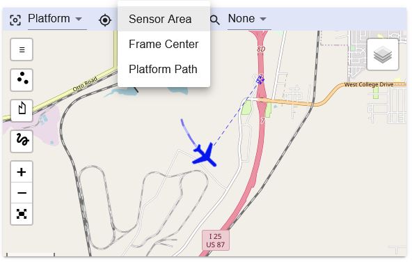
Area Of Interest (AOI)
Before performing any query, select the desired area of interest:
- Filmed area - query filmed area information (based on corner points)
- Frame center trail - query center of FOV trail
- Platform path - query the platform's swath path
Results are returned only when the relevant metadata is present in the mission database. For example, if there are no corner points (offsets or full) it is impossible (without calculating them from FOV and other data) to get the filmed area information.
Query types
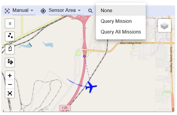
Filter missions
This query type can be used for finding missions that have video content geographically related to the specific area of interest: Perform query by drawing one of the following shapes on a map:
- Polygon (intersect)
- Rectangle (intersect)
- Point (include)
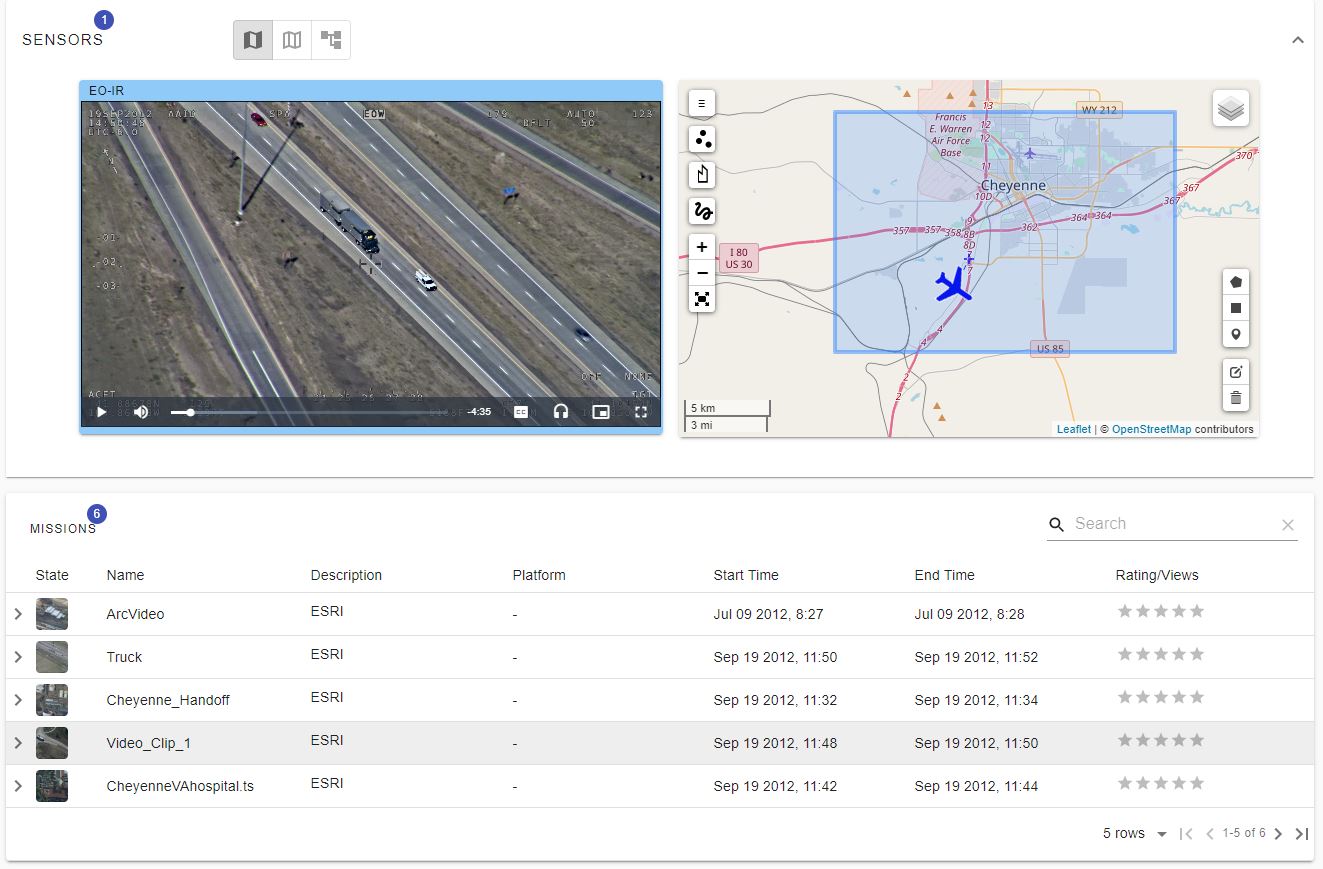
To find missions that contain a video taken in a particular region of interest, select the Filmed area query type in the map menu. Use the drawing tools on the map to select the desired area. You can draw a rectangle, polygon or just set a marker point. Your web client will now query the server and return a list of missions that covered the selected area. The mission panel should now contain only the relevant missions. You can add additional criteria to your search, for example, restrict the search to a specific time range.
Query one particular mission
This query type can be used to locate a relevant part of a video using geographic coordinates.
- Polygon (intersect)
- Rectangle (intersect)
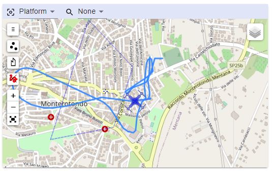
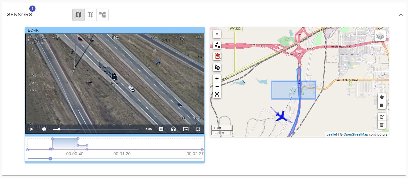
It is effectively a video coverage query—a very useful tool that graphically shows exactly where in the video clip you can find the locations selected on the map. As shown below, the place selected on the map was filmed only at the beginning of the mission, so if this is the only location we're interested in, there is no need to review the entire video.
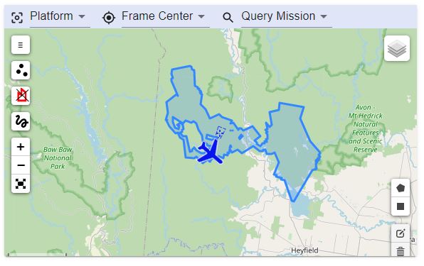
Show filmed area
The area polygon is calculated from corner points (offsets or full).
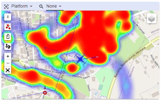
Show area of interest (heat map)
The heatmap emphasizes the area the operator focused the camera most of the time.
Show path
This query shows a swath path built from the platform's coordinates.