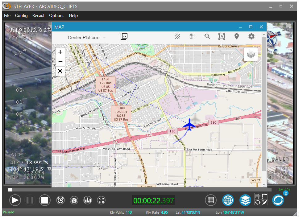
Map View
Map view greatly improves your situational awareness by presenting the Platform, Footprint, Frame center, Target, GeoJSON Annotations, etc on a configurable map.
You can open a Map Window by pressing the Map button.
- Note
- You need to be connected to the Internet (or setup off-line map) in order to use base maps from the Map Layer list.
Filmed Area
Upon ingest completion StPlayer automatically calculates the entire filmed area that can be presented on a map.
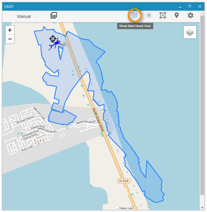
- Note
- Area calculation is only possible if the relevant metadata is available (Corner points - tags 26-33 or full coordinates - tags 82-89)
HeatMap
Additionally to the filmed area presentation, StPlayer can emphasize the places where most of the attention was paid to (camera spent most of the time) as a heatmap.
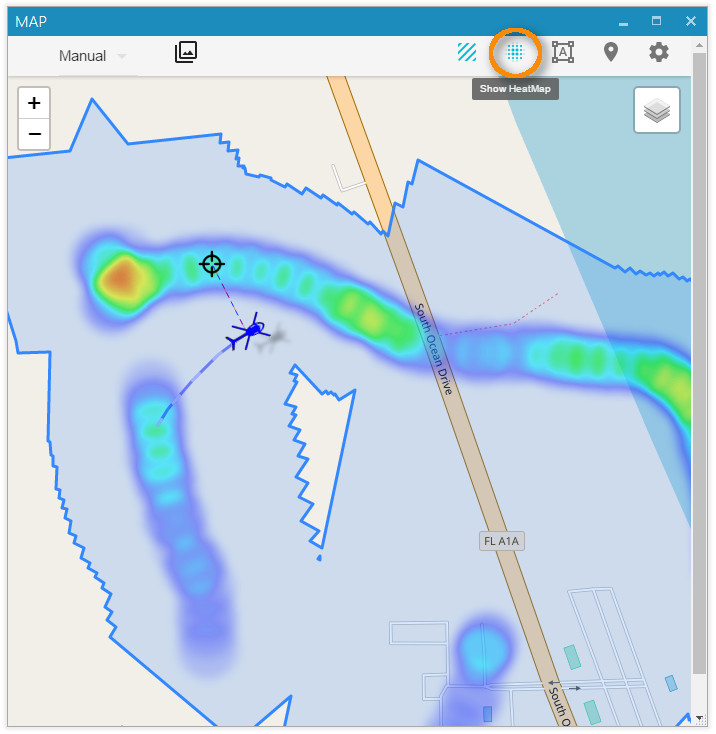
- Note
- HeatMap presentation is only possible if the relevant metadata is available (Frame center - tags 23-24)
Video Coverage
Video Coverage query helps you quickly find a relevant video segment by specifying an area on the map. The query will graphically show where exactly in the video clip you can find the places selected on the map. For example, we have a long video footage where the sensor follows the river. The aircraft goes all the way to the place where the river meets the ocean and returns back. We're only interested in the specific video segment where the river flows into the ocean.
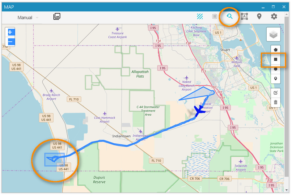
By designating the Area of Interest we immediately get the following chart:
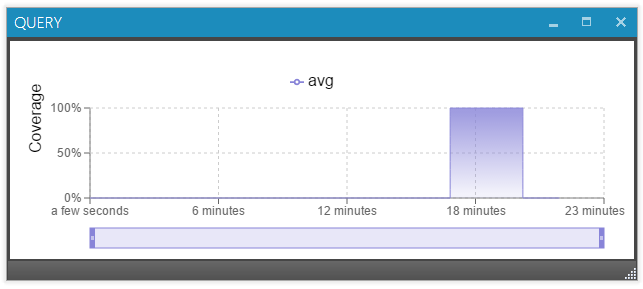
We can now see that the relevant video starts 18 min into the movie. All we have to do is to click the chart at the beginning to get to the start of the segment or click at the end to get to the place where the aircraft has left the area.
MIL-STD-2525 STANAG 2019 APP6 Symbology
StPlayer map can overlay MIL-STD-2525 tactical symbology.
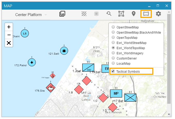
The supported data format is a GeoJSON with MIL-STD-2525 specific information (like SIDC) added as a properties. Here is an example of the json file that can be uploaded to the map.
You can either load it manually via map's menu or use StPlayer automation command /map/milsymbols, providing json formatted data in the message body:
Offline Maps
StPlayer can use downloaded maps of pre-selected regions when the PC lacks network connectivity.
Local Files
StPlayer comes with (an optionally installed) high level world map.
The default location of the tiles:
"C:\Program Files\ImpleoTV\StPlayer\Bin\x64\resources\map\map-tiles"
It is possible to add / replace the tiles with pre-downloaded ones of the area of interest.
Custom Tile Server
It is also possible to use a custom Map server - installed locally or on the Intranet.
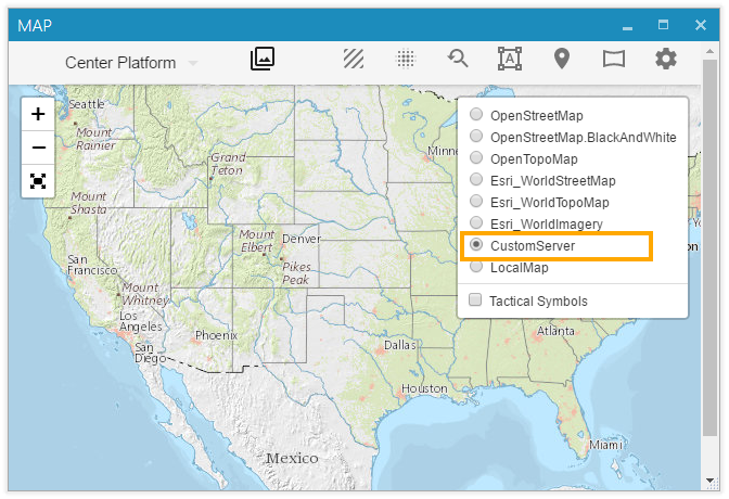
Server's url can be configured at the Map Settings page.
By default, it is configured for local files. Use http://<IP>:<Port>/<tileslocation>/{z}/{x}/{y}.png (or .jpg) url to point to your internal map server

- Note
- To display maps from TMS service use {-y} in the URL, for example http://base_url/tms/1.0.0/tileset/{z}/{x}/{-y}.png. This is required because the origin of coordinates of a map layers is the top left corner, so the Y coordinate goes down. In TMS, the origin of coordinates is the bottom left corner so the Y coordinate goes up.
Offline Maps creation
There are many ways to create local map tiles (free and paid). One of the easiest would be to use a Mobile Atlas Creator .
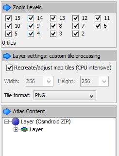
Select the area and required zoom levels you need and save Atlas as OSMdroid ZIP. This will create a zip folder of the image tiles you need in the format: {atlas_name}/{z}/{x}/{y}.png Extract this folder of map tiles somewhere. Now, you can use the tiles offline - locally, by copying them to the StPlayer map directory, as described above or by setting up a simple web server on your local computer or your Intranet.
You can also build tiles from GeoTiff files. SW like Gdal or Maptiler application will do the job.